Laser Scanning Services
Laser Scanning Services
Laser Scanning Services
Laser Scanning
Full Range of Services Provided
Our laser scanning services, where precision meets efficiency in capturing the real-world conditions of any construction or renovation project. Leveraging state-of-the-art laser scanning technology integrated with Building Information Modelling (BIM), we provide detailed and accurate representations of physical spaces that serve as the foundation for precise modelling and analysis.

On-site 3D Laser Scanning
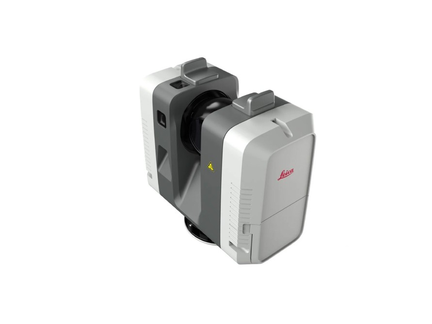
The latest Leica 360-degree scanners offer high-precision scanning, capturing environments in stunning detail. They provide both black and white or colorised scans, ensuring versatile applications for various professional and industrial needs.

Processing
Scan registration ensures accurate alignment of multiple scans. Point Cloud cleanup removes noise and errors for clarity. Export for CAD/Revit facilitates seamless integration into architectural and engineering workflows.

360 Picture Walkthroughs
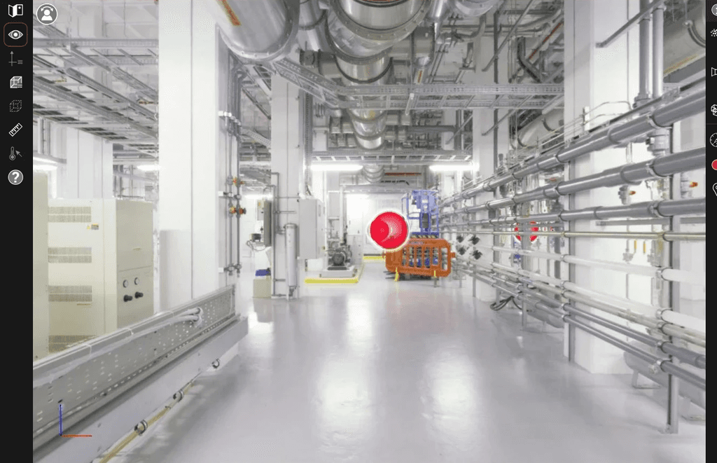
HDR 360 pictures from each scan position capture vibrant, high-detail images. Digital interactive walk-throughs enable immersive exploration of scanned environments, enhancing visualisation and client presentations.

Scan to BIM
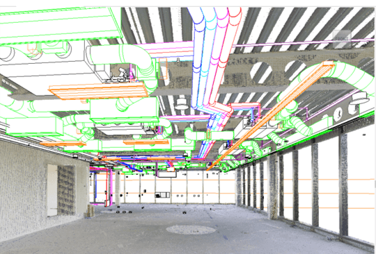
Conversion to RVT model transforms scans into Revit-compatible files for architectural design. Conversion to CAD drawings converts scan data into precise CAD formats, aiding in detailed engineering planning. Integration into existing Revit models seamlessly incorporates new data into ongoing projects.

On-site 3D Laser Scanning
The latest Leica 360-degree scanners offer high-precision scanning, capturing environments in stunning detail. They provide both black and white or colorised scans, ensuring versatile applications for various professional and industrial needs.

Processing
Scan registration ensures accurate alignment of multiple scans. Point Cloud cleanup removes noise and errors for clarity. Export for CAD/Revit facilitates seamless integration into architectural and engineering workflows.

360 Picture Walkthroughs
HDR 360 pictures from each scan position capture vibrant, high-detail images. Digital interactive walk-throughs enable immersive exploration of scanned environments, enhancing visualisation and client presentations.

Scan to BIM
Conversion to RVT model transforms scans into Revit-compatible files for architectural design. Conversion to CAD drawings converts scan data into precise CAD formats, aiding in detailed engineering planning. Integration into existing Revit models seamlessly incorporates new data into ongoing projects.

On-site 3D Laser Scanning
The latest Leica 360-degree scanners offer high-precision scanning, capturing environments in stunning detail. They provide both black and white or colorised scans, ensuring versatile applications for various professional and industrial needs.

Processing
Scan registration ensures accurate alignment of multiple scans. Point Cloud cleanup removes noise and errors for clarity. Export for CAD/Revit facilitates seamless integration into architectural and engineering workflows.

360 Picture Walkthroughs
HDR 360 pictures from each scan position capture vibrant, high-detail images. Digital interactive walk-throughs enable immersive exploration of scanned environments, enhancing visualisation and client presentations.

Scan to BIM
Conversion to RVT model transforms scans into Revit-compatible files for architectural design. Conversion to CAD drawings converts scan data into precise CAD formats, aiding in detailed engineering planning. Integration into existing Revit models seamlessly incorporates new data into ongoing projects.
Equipment
RTC 360
Full 360 ° x 270 ° coverage
3 cameras collecting panoramic images
130 meter range
2 million points per second
3 resolution settings available
Each scan complete in 1:51 mins

BLK 360
Lightweight
One - button operation
Coverage - 360 ° (horizontal) / 300 ° (vertical)
3 - camera system + thermal panoramic camera

DJI Mavic 3
Weight - 895 g
Max Altitude - 6000 m
Max Flight Time - 46 minutes
Flight distance range - up to 30 km
Global Navigation Satellite System
GPS + Galileo + BeiDou

Equipment
RTC 360
Full 360 ° x 270 ° coverage
3 cameras collecting panoramic images
130 meter range
2 million points per second
3 resolution settings available
Each scan complete in 1:51 mins

BLK 360
Lightweight
One - button operation
Coverage - 360 ° (horizontal) / 300 ° (vertical)
3 - camera system + thermal panoramic camera

DJI Mavic 3
Weight - 895 g
Max Altitude - 6000 m
Max Flight Time - 46 minutes
Flight distance range - up to 30 km
Global Navigation Satellite System
GPS + Galileo + BeiDou

Equipment
RTC 360
Full 360 ° x 270 ° coverage
3 cameras collecting panoramic images
130 meter range
2 million points per second
3 resolution settings available
Each scan complete in 1:51 mins

BLK 360
Lightweight
One - button operation
Coverage - 360 ° (horizontal) / 300 ° (vertical)
3 - camera system + thermal panoramic camera

DJI Mavic 3
Weight - 895 g
Max Altitude - 6000 m
Max Flight Time - 46 minutes
Flight distance range - up to 30 km
Global Navigation Satellite System
GPS + Galileo + BeiDou

Laser Scanning
Software
By choosing our BIM-Specific Laser Scanning Services, you gain access to a powerful tool that minimises uncertainties and maximises project success through detailed, reliable data capture and analysis.
Transform your project approach with our dedicated laser scanning capabilities, ensuring every detail is accounted for with unmatched precision and efficiency.


